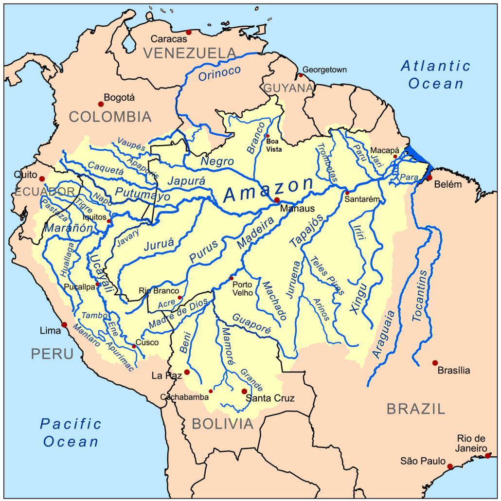
Amazon River Basin
The Amazon rainforest of Ecuador or “El Oriente” of Ecuador is the country’s largest region. Nothing is just ordinary in the Ecuadorian Amazon. Ecuador’s Amazonian jungle, one of the country’s most thrilling destinations. At first glance, the rain forest is a vast green wilderness. However, as one observes carefully, this ecosystem is full of surprises for its visitors.
This area has the highest biodiversity in Ecuador, with more than 800 species of birds, more than 2500 types of insects and more than 450 species of endemic flora.
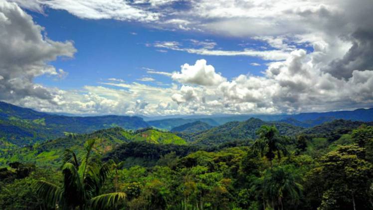
No other Ecuadorian habitat overwhelms the senses like the tropical rainforest, with its cacophonous soundtrack of birds and insects, the rich smell of steaming foliage and teeming soil, the glimmer of fluorescent birds and butterflies in the understory, or the startling clamour of a troop of monkeys clattering through the canopy above.
To give you an idea just how great the Amazon is, there are islands in the Amazon River that are nearly as big as the country of Switzerland in Europe.
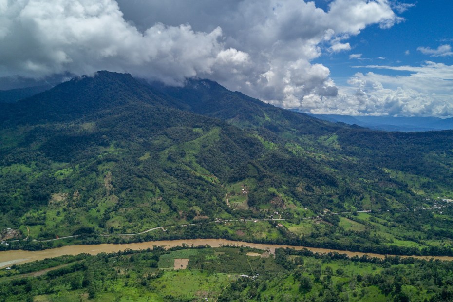
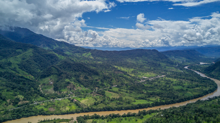
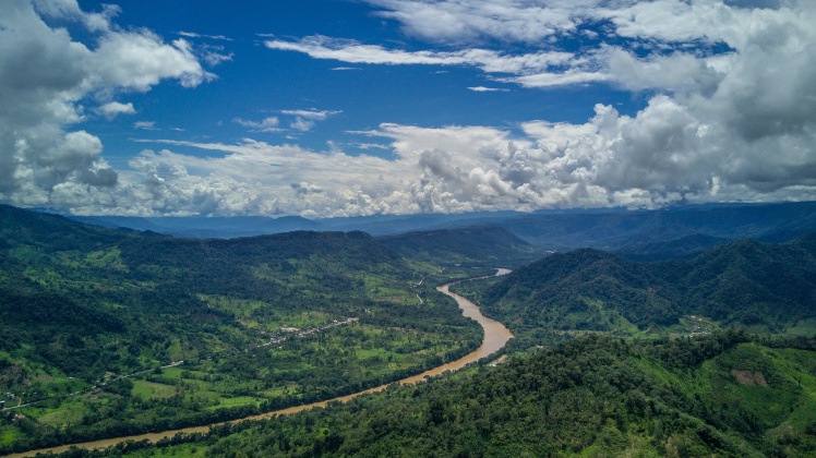
This is the Oriente’s star attraction, and what most visitors are here for – though the region, which occupies a massive area covering almost half the country, contains a good deal more besides. The alto (high) Oriente starts on the eastern Andean flank, where the high, windswept páramo steadily gives way to dripping montane forests, swathed in mist and draped with mosses and epiphytes, as the elevation decreases. Waterfalls plunge into broadening valleys, and temperatures rise the further you descend. Down in the foothills, poised between the sierra and the lowlands, lies a beguiling landscape of rippling hills and verdant, subtropical forests, home to a startling diversity of birds. Continuing east, the mountain ridges eventually taper away into the bajo (low) Oriente like talons sinking into the deep velvet of a vast emerald wilderness.
Population
One of three regions (the costa, the sierra and the oriente), the Oriente contains nearly half of the square footage of the country, but less than 5% of the 12.5 million population of Ecuador. Zamora - The City of Birds and Waterfalls If you’re looking for a destination in Ecuador with a difference, Zamora might just be what you had in mind. With only about 16,000 people living in the entire Zamora-Chinchipe province, this is one of the most sparsely populated parts of the country.
Southern Oriente
Ecuador’s southern Oriente is less developed than its northern counterpart in every way, with fewer roads, fewer towns, fewer tourists and less oil activity. The region’s two main population centres are Puyo, the provincial capital of Pastaza, and Macas, 129km further south, capital of the province of Morona-Santiago. Settlement by colonists is largely confined to a long, thin strip flanking the Troncal Amazónica (the Amazon highway), which runs from north to south through the region, in the selva alta, parallel with the eastern flank of the Andes. This road, mostly paved between Puyo and Limón, is virtually the only road in the southern Oriente, with access east into the heart of the tropical rainforest possible only by boat along the numerous rivers coiling through the forest, or by chartered light aircraft.
Climate
The climate in the low Oriente is what you’d expect from a rainforest – hot, humid and plenty of rain. The wettest months are April to July, but expect cloudbursts most days year round, usually in the early afternoon. Average daytime temperatures are around 25°C, though daily highs can be over 32°C. With such consistent conditions, the Oriente doesn’t have a high tourist season; at slow times of year, when there are few tourists in the country as a whole (Feb to mid-June & Sept–Nov), it’s worth asking for discounts.
History
Human settlements have existed in the Oriente since sometime around 2450 BC. Early indigenous of the Oriente lived in a region rich in natural resources: rivers, plants, tropical fruits and of course–gold.
The Quijos region east of Coca was well known to the Incas, who ventured downhill to meet lowland tribes in peace and battle. It was also the first area east of the Andes to be penetrated by the Spanish. The anniversary of the European discovery of the Amazon River (February 12) is still celebrated in jungle cities with markets and fairs. Within a few centuries after European contact most of the region’s tens of thousands of inhabitants had fallen victim to smallpox and cholera.
Rumour’s of the jungle being el pais de canela (“the land of cinnamon”), a place of abundant fruits and spices, and the legend of El Dorado, the “Golden Man”, drew the early explorers here, suggesting to them a land of staggering natural riches.
The first Europeans to venture here soon found this fabled earthly paradise had a nightmarish underside; their parties were plunged into an impenetrable green hell (“el infierno verde”), teeming with poisonous snakes and biting insects. A string of catastrophic expeditions in the early colonial period quickly discouraged the Spanish from colonizing the Oriente at all.
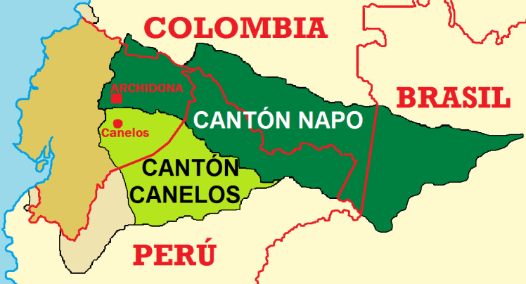
The name itself “El Oriente” has its origins from back in time. The great province of Oriente was created during the first government of Gabriel Garcia Moreno in 1861, under a character of Special District with capital in Archidona. The province consisted of two cantons, the Napo canton whose capital was Archidona and the Canelos canton whose capital was Canelos.1 The Oriente was dissolved on December 15, 1920 in the Napo Pastaza and Santiago Zamora provinces by the government that presided over the José Luis Tamayo .
In 1861, just thirty years after Ecuador had declared its independence from Gran Columbia, the territory called the Oriente was designated after Ecuador and Peru signed a treaty defining each others borders. In 1941, Peru grew ambitious and invaded Ecuador occupying more than half of its territory in the eastern Amazon basin in a 10 day war. A treaty was negotiated in favor of Peru a year later. The U.S., Brazil, Chile, and Argentina agreed to act as guarantors of the peace treaty. The U.S. Air Force completed mapping and marking most of the borders of the Oriente by 1947. But because of the hope of finding gold, uranium, and oil, there was no resolution in Ecuadors mind and in 1995, war flared up again between the two countries. It was not until the 1998 that Ecuador finally acquiesced and allowed Peru to keep the territory–putting to end one of the longest territorial disputes in the western hemisphere.
Even until the 1960s, most people, save for a sprinkling of missionaries and pioneers, kept away, leaving the forests and its inhabitants well alone. This all changed in the late 1960s following the discovery of large oil and gas reserves, now the country’s most important source of wealth. The Oriente was divided into 200-square-kilometre bloques (blocks) and distributed between the companies, who proceeded to drill and blast in search of black gold. Roads were laid, towns sprouted virtually overnight and large areas of rainforest were cleared. The Oriente was transformed into a “productive” region and colonists streamed in on the new roads, looking for jobs and levelling still more land for farms.
But it was in the 1990s that yet a new gold was discovered in the Oriente: whitewater rivers and the promise of tourism. Already a paradise in its untouched, cloud forest/rain forest setting, tourism in the Oriente still mainly consisted of adventurous souls looking to explore Ecuadors Amazon area with trips to such jungle retreats as Cuyabeno. The majority of Ecuadorians still shuddered at the thought of traveling to the Oriente–for fear of wild indians, giant snakes and unpaved roads. But the discovery of Ecuadors whitewater treasure brought a whole new type of traveler into the tourism mix: kayakers and rafters.
Zamora-Chinchipe
The southernmost province in El Oriente, Zamora Chinchipe is the mining centre of Ecuador, with gold mines at Nambija, Chinapinza, and Guayzimi. The provincial capital, Zamora is accessed by the road from Loja, and Podocarpus National Park in the cloud forest between Loja and Zamora is popular with hikers.
Valle de las Luciérnagas - Valley of Fireflies
The famous Yantzaza Valley or Valley of Fireflies (Spanish: Valle de Yantzaza o Valle de las Luciérnagas). The origin of its name comes from the word “yanzatza” in Shuar which means “valley of the fireflies,” due to the constant presence of fireflies in the area. Yantzaza is a town in that region, the Zamora Chinchipe province of Ecuador. Because of its proximity to the border with Peru, some travelers pass through the town on their journey to northern Peru.
Finca Yantza
Now you know why we choose the amazon region of Ecuador for our tropical permaculture regeneration farm. And why its called “Finca Yantza“.