A good tropical permaculture design plan is generally focused on long-lasting, low maintenance, high accessibility while enjoying abundant food supply and the fauna biodiversity.
The process of designing a smart efficient rural homestead is like putting together a puzzle. A good permaculture farm design helps you to focus your time and efforts for a low-maintenance homestead. Having the knowledge how to plan and organize your property depending on your determined objectives into future goals. By planning zones, improving access, growing an abundant supply of edibles food with low maintenance. For new landowners it can be of enormous help to plan your future natural home and the structures around, it depending on your needs. You will better understand what’s available on your site. How it could be transformed to meet your future needs. And so enhancing your long term experience having a low maintenance but abundant edible food supply.
“Our goals can only be reached through a vehicle of a plan, in which we must fervently believe, and upon which we must vigorously act. There is no other route to success.”
Pablo Picasso
A Permaculture Zone Design Plan considers all aspects of various eco-systems within the local environment. It’s a way of combining edible landscaping, access, water, sunlight, climate, waste, beneficial insects, community, animals, energy and more, into a cohesive, functioning equation that creates re-generative systems.
BTW: Check out our tropical permaculture consultancy services
Example Of Permaculture Designs Maps
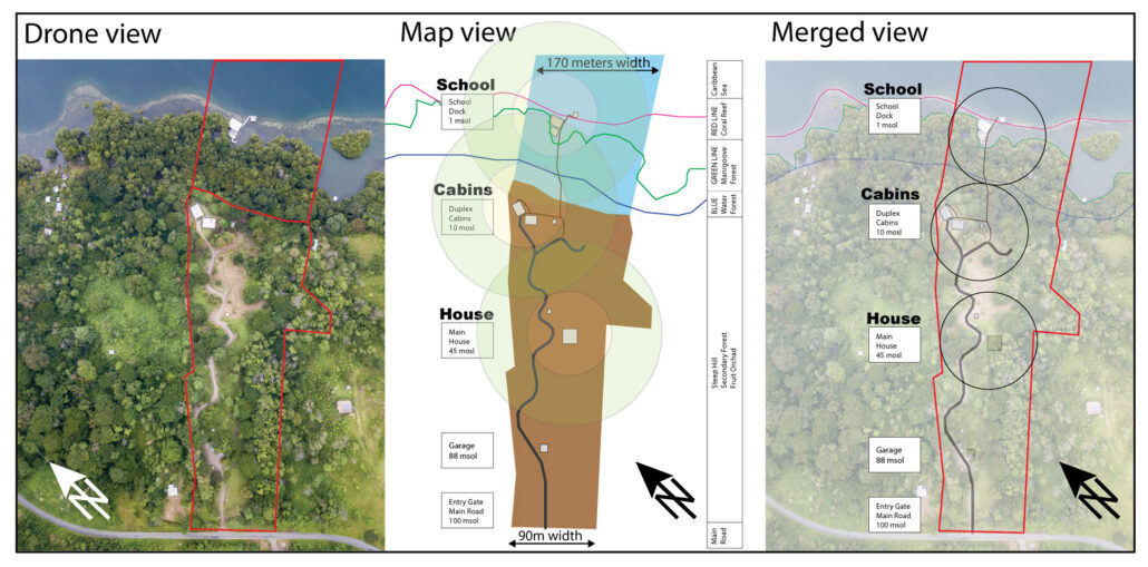
Inicial Site Analysis
Collection, Analysis and Classification of Information
- 3D Aerial Photo
- Site Illustration
- Merged view
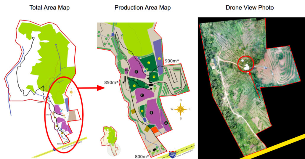
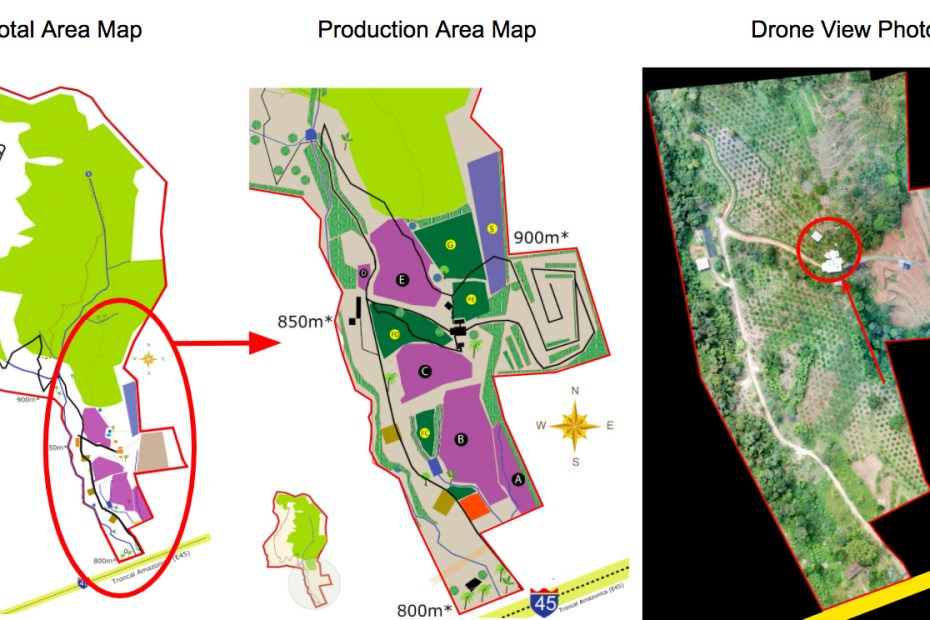
Master Plan Overview 3 in 1
Constant Collection, Analysis and Classification of Information
- Illustration of Total Area
- Illustration of Production Zones
- 3D Aerial Photo of the Productive Area
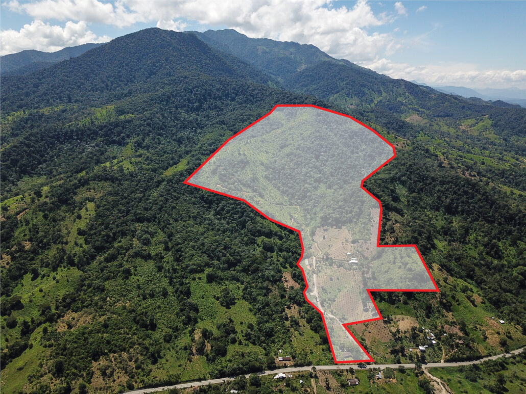
Drone Property Photography
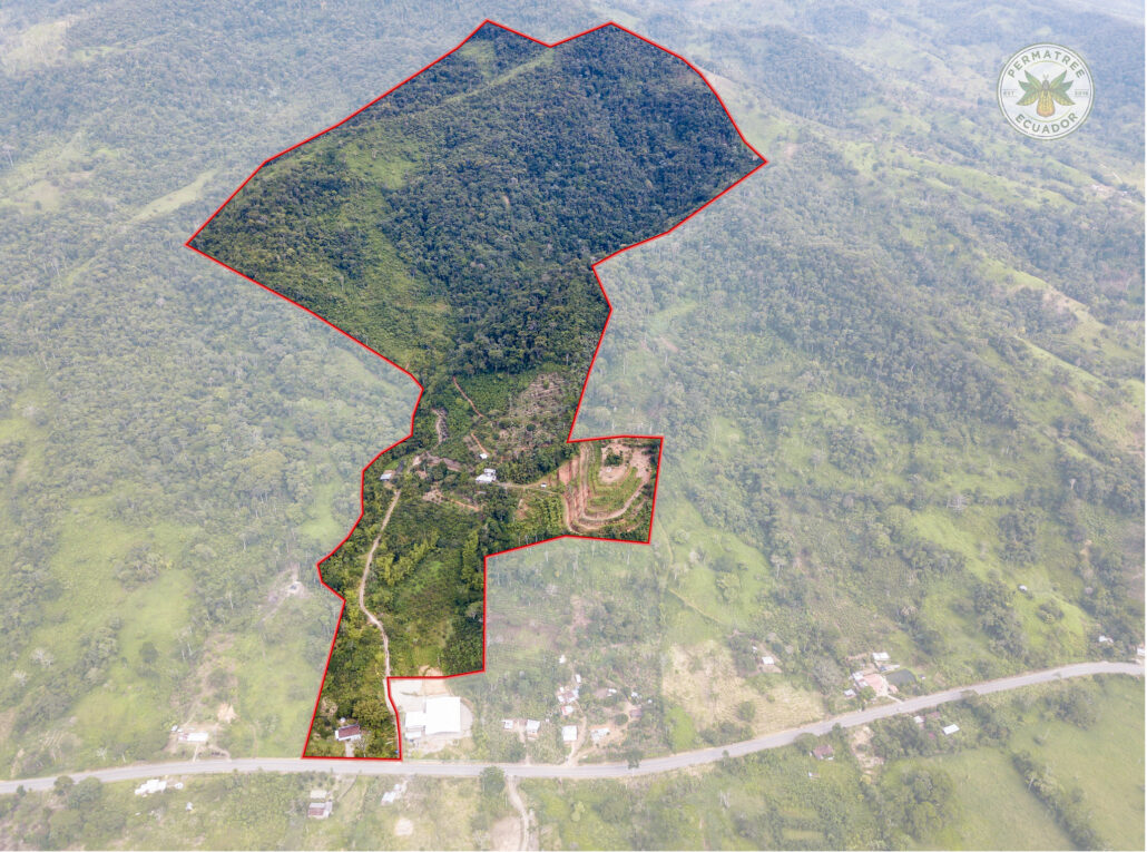
3D Aerial Drone Photography of the Total Farm area negative-highlighting the farm boundaries red.
Drone Property Photography
3D Aerial Drone Photography of the Total Farm area positive-highlighting the farm boundaries red. Absolutely helps to better visualize properties from different point of view.
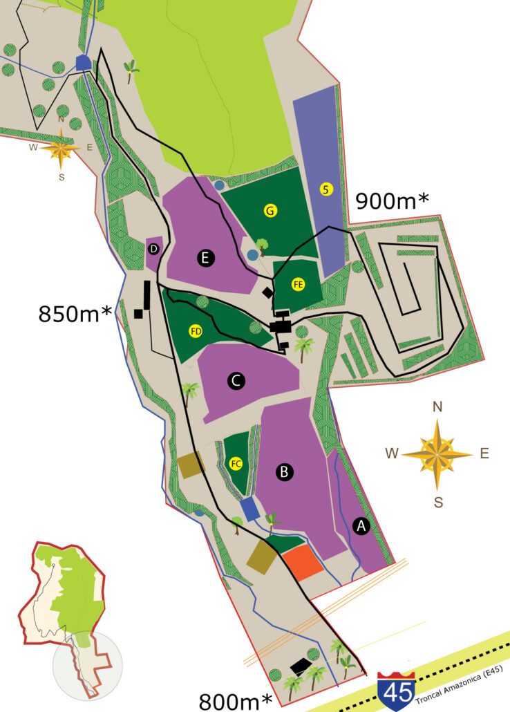
Masterplan: Zones of Use
Overview of the classification of Information for better Analysis
- Tropical Farm Zones
- Productive Fruit Zones
- Bamboo Zones
- Public And Private Access Roads
- Access Trails within the Zones
- Farm boundaries
- Food forest
- Bamboo agroforestry
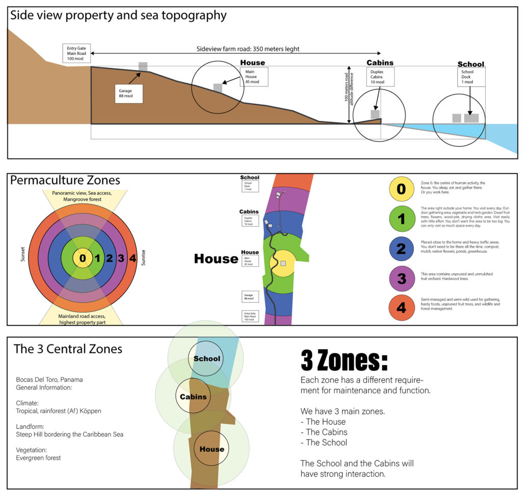
Inicial Site Survey
Collection, Analysis and Classification of Information
- Permaculture Zones
- Central 3 Zones
- Main Road Access
- Sea Access
- Topography
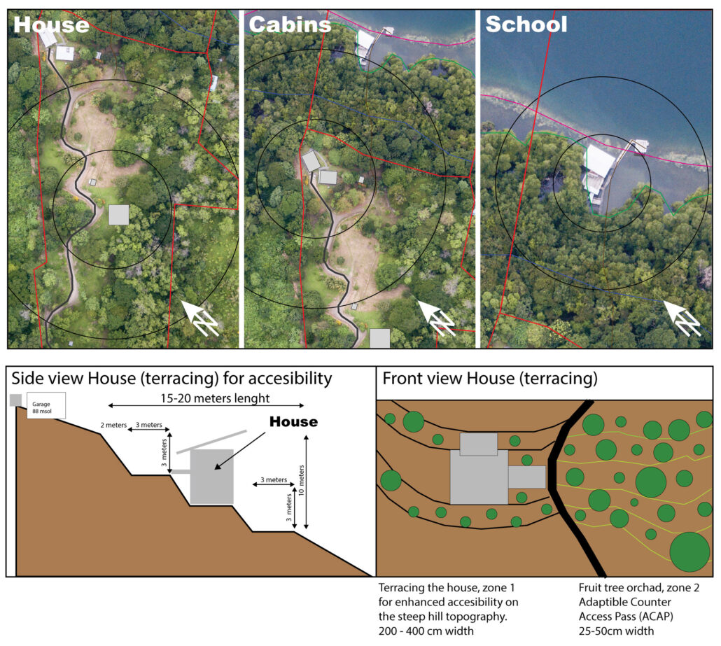
Aerial Drone Site Survey
Collection, Analysis and Classification of Information
- Existing Structures on site
- Main Access Roads
- Future Terracing on Steep Hill